
Digital mapping platforms have become central to the modern understanding of geography, sovereignty, and navigation, but a recent development involving Apple Maps has sparked significant international concern and debate regarding the representation of Southern Lebanon. Reports surfaced over the weekend indicating that Apple’s proprietary mapping service has removed nearly every town and village label in the southern region of Lebanon, a move that coincides with escalating military tensions between Israel and Hezbollah. While adjacent territories in Israel and Syria remain fully detailed with comprehensive labeling of even small settlements, the Lebanese landscape south of the Litani River appears, on the digital interface, to have been virtually depopulated of its civilian markers. This discrepancy has raised urgent questions regarding whether the change is a technical glitch, a response to a cyberattack, or a deliberate policy decision by the Cupertino-based tech giant.
Observations of Cartographic Discrepancies
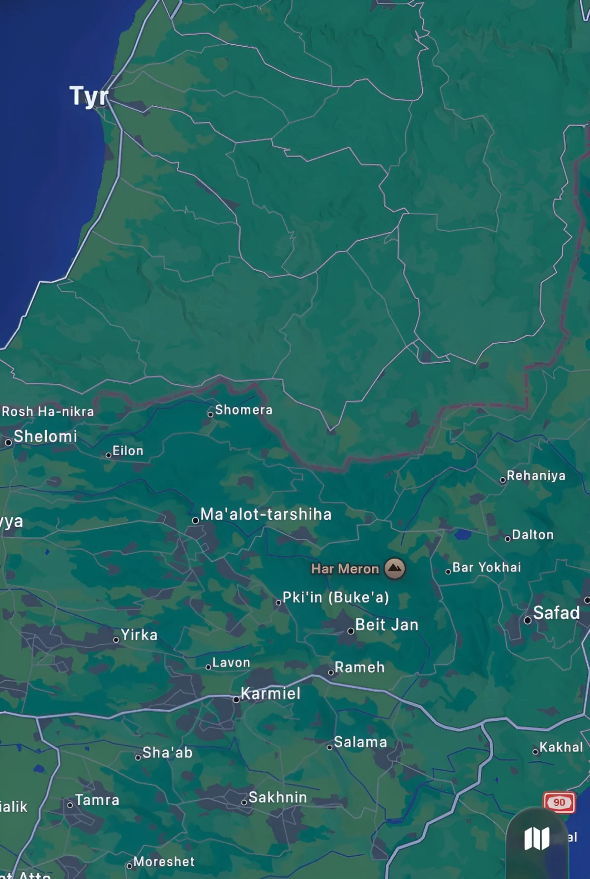
The controversy gained momentum after social media users and open-source intelligence (OSINT) analysts highlighted the stark visual difference between Apple Maps and other major mapping services. On the Apple Maps interface, the area comprising Southern Lebanon—traditionally home to hundreds of thousands of civilians across hundreds of municipalities—currently displays as a largely blank topographic space, devoid of the standard markers for residential areas, historical sites, and municipal centers.
In contrast, Google Maps continues to provide detailed labeling for the same coordinates, identifying towns such as Bint Jbeil, Tyre, and Marjayoun with their customary clarity. Furthermore, the Apple Maps interface maintains a high level of detail for Northern Israel and Southwestern Syria, where every kibbutz and village is clearly demarcated. This asymmetrical data presentation has led to accusations of cartographic bias, with critics arguing that the erasure of Lebanese place names undermines the recognized international borders and the sovereign identity of the region.
The Geopolitical Context: Conflict and Sovereignty
The timing of this digital erasure is particularly sensitive given the current geopolitical climate. Southern Lebanon is currently the site of intensive military engagements. The region has historically been a flashpoint, defined by the "Blue Line"—the withdrawal line established by the United Nations in 2000. Recently, rhetoric within certain factions of the Israeli government has shifted toward the possibility of establishing a "buffer zone" or even the annexation of Lebanese territory up to the Litani River to ensure the security of northern Israeli settlements.
In this high-stakes environment, the labels on a map are more than just navigational aids; they are digital assertions of presence and legitimacy. Analysts suggest that the removal of these labels could be perceived as a "virtual depopulation," providing a digital landscape that mirrors the desired outcomes of certain political actors. The fear among Lebanese officials and international observers is that such cartographic changes could be used to normalize the absence of civilian infrastructure in the eyes of the global public, potentially softening the diplomatic impact of military incursions or long-term occupation.
Technical Possibilities and Digital Vulnerabilities
While the political implications are severe, several technical explanations remain under investigation. One possibility is a massive data corruption event or a localized error within Apple’s Content Delivery Network (CDN). Digital mapping services rely on complex layers of data provided by third-party vendors, such as TomTom and various governmental Geographic Information System (GIS) databases. A failure in the handshake between these databases and Apple’s rendering engine could result in the loss of specific data layers, such as town labels.
Another significant possibility is a sophisticated cyberattack. In the era of hybrid warfare, state-sponsored actors frequently target the digital infrastructure of their adversaries or the third-party services they rely on. Disrupting the geographic data of a conflict zone can sow confusion among civilians trying to evacuate and complicate the efforts of humanitarian organizations relying on digital tools for logistics.
However, some industry experts point to Apple’s history of adjusting its maps in response to government requests or local laws. For instance, Apple and Google have previously altered how they display borders in disputed regions like Crimea or the Golan Heights depending on the country from which the map is being viewed. If Apple received a request to "sanitize" the map for security reasons—similar to how live traffic data is often disabled in war zones to prevent the tracking of troop movements—the implementation may have been overly broad, resulting in the total removal of town labels rather than just dynamic data.
Comparative Chronology of Mapping Controversies
This incident is not the first time a major tech company has faced backlash for its cartographic choices. The history of digital mapping is replete with instances where software updates have had real-world political consequences:

- Crimea (2014-2019): Following the annexation of Crimea by Russia, both Apple and Google faced immense pressure to change the region’s borders. Eventually, Apple Maps began showing Crimea as part of Russia to users within Russia, while showing it as disputed or part of Ukraine to the rest of the world.
- Palestine and Israel: For years, activists have criticized Google and Apple for the lack of labeling for Palestinian villages in the West Bank compared to neighboring Israeli settlements.
- The Persian Gulf vs. Arabian Gulf: Mapping companies have frequently navigated the naming dispute of the body of water between Iran and the Arabian Peninsula, often opting for dual labels or changing labels based on regional IP addresses.
- The 2026 Lebanon Update: The current incident in Southern Lebanon represents a new frontier in these controversies, as it involves the total removal of existing, internationally recognized civilian centers during an active conflict.
Initial Responses and Community Feedback
Following the viral spread of the Apple Maps screenshots, the tech community has offered a variety of perspectives. Some long-term users of Apple Maps have suggested that the platform’s coverage of Lebanon has historically been inferior to Google Maps. These users argue that the "removal" might actually be a long-standing lack of data that has only now come under the spotlight due to the war.
However, OSINT researchers have countered this by providing archived screenshots from earlier in the year, which appear to show that many of these town labels were indeed present prior to the recent escalation. This suggests a specific, recent change rather than a chronic data deficit. Apple has yet to issue a formal statement addressing whether this change was intentional or an unintended consequence of a software update.
The Role of Big Tech in Modern Warfare
The situation in Southern Lebanon highlights the immense power held by a handful of Silicon Valley companies. When Apple or Google makes a change to their maps, it affects the perception of millions. In conflict zones, these maps are used by journalists to report on strikes, by NGOs to coordinate aid, and by civilians to find safety.
The "erasure" of towns on a map can have a dehumanizing effect, as it renders the civilian cost of war invisible on the platforms most frequently used by the global North. If a village does not exist on a map, a strike on that location may be reported simply as a strike on "open terrain" or a "military position," rather than a populated area. This places a heavy ethical burden on tech companies to maintain the integrity of their geographic data, regardless of the political pressure they may face.
Broader Implications for International Law
From a legal standpoint, the representation of borders and territories on commercial maps does not change international law, but it does influence "customary" perception. The United Nations and the majority of the international community recognize Southern Lebanon as sovereign Lebanese territory. Any digital move that appears to validate the erasure of that sovereignty could be seen as a violation of the spirit of international agreements regarding the respect for established borders.
If it is discovered that Apple purposefully removed these labels at the request of a foreign government to facilitate military operations or political claims, the company could face significant legal and reputational challenges. This would mark a shift from tech companies being neutral platforms to becoming active participants in territorial disputes.
Future Outlook and Monitoring
As the situation on the ground in Southern Lebanon remains fluid, the digital representation of the region is expected to remain a point of contention. Observers are calling for Apple to restore the labels immediately to ensure that the civilian infrastructure of Southern Lebanon is recognized and visible.
Technological transparency is becoming a key demand from digital rights advocacy groups. There is a growing movement calling for "Cartographic Accountability," which would require companies like Apple and Google to log and explain any significant changes to geographic data in conflict-sensitive areas. Until such transparency is achieved, the blank spaces on the map of Southern Lebanon will continue to serve as a controversial symbol of the intersection between technology, power, and war.
We will continue to monitor the Apple Maps interface for any restorations of data and will provide updates as more information regarding the cause of this discrepancy becomes available. The international community remains watchful, noting that in the 21st century, the fight for territory is fought not only on the ground but also on the screens of billions of devices worldwide.